

Avdat the Nabatean
- Nov 30, 2025
- 9 min read
In 2005, UNESCO decided to add to their World Heritage list the Nabatean sites in Israel along the route of the incense. This route (or rather a network of routes) connected far away lands in Yemen and Ethiopia across the Arabian Peninsula and crossed the Negev desert in present-day Israel to reach the ports of the Mediterranean Sea. The Nabateans were the nomadic people who crossed these vast deserts to sell their precious goods such as myrrh (מור) and frankincense (לבונה) to the peoples of the Mediterranean Basin. And they built many stations along this route, mostly "caravanserai", called khan's in Arabic (חאנים), to allow their caravans of camels to stop for the night, in a fortified enclosure.

The key element that decided where to build such stations was the presence of water which, in the Negev desert, only happens during the rainy winter and its seasonal flash floods. Indeed, in this region of the Negev, the annual rainfall is only about 80 mm: rain is not enough but river floods are good to fill up cisterns to last many months. The Nabateans crossed these deserts at the right time of year.
Here is a short history of this ancient people and of Avdat the main Nabatean archaeological site you may visit in Israel if you tour the southern parts of the country.
History of the Nabateans
According to tradition, the Nabateans were a people issued from a Biblical patriarch called Nebaioth, the eldest son of Ishmael son of Abraham (for more information, click here and check year 1589 BCE). They had developed their trade across the deserts of the Arabian Peninsula, in the same way that a neighboring Biblical people called the Midianites, also issued from Ishmael, developed their trade across the Sinai Peninsula towards Egypt. Their existence is mentioned in the Bible when Joseph was sold by his brothers:
And there passed by Midianites, merchantmen; and they drew and lifted up Joseph out of the pit, and sold Joseph to the Ishmaelites for twenty shekels of silver. And they brought Joseph into Egypt. (Genesis 37:28)
You may note that the price paid for Joseph, 20 shekels of silver, was indeed the price for a male slave in antiquity. The price is mentioned in the Bible:
And if it be from five years old even unto twenty years old, then thy valuation shall be for the male twenty shekels, and for the female ten shekels. (Leviticus 27:5)
Over one thousand years later, Judas was paid 30 coins of silver to betray Jesus, which was about the price of a slave:
Then one of the twelve [disciples] — the one called Judas Iscariot — went to the chief priests and asked, “What are you willing to give me if I deliver him [Jesus] over to you?” So they counted out for him thirty pieces of silver. (Matthew 26:14-15)
From the 5th century BCE, the Nabateans extended their reach to the shores of the Mediterranean Sea, mostly towards the harbour of Gaza (for the history of ancient Gaza, click here). They were able to do so because the Levant region had been devastated by the successive invasions from the Assyrians and from the Babylonians. Ancient kingdoms in Aram, Phenicia, Samaria, Judah and Philistia were utterly destroyed. And their populations displaced. The Nabateans filled the vaccum in the southern desertic region, by establishing stations along the nomadic route, and they rebuilt a harbour in Gaza to export their expensive goods. Their capital was Petra, in modern-day Jordan, which was situated at the border between the ancient kingdoms of Moab and Edom (to assess a tour to historical Petra, click here).
With the Persian period, a peace reigned over a vast homogeneous empire made up of 127 provinces. At the time, the Judean province started to rebuild again with the return of Judeans (Jews) to Zion (Jerusalem). On their side, the Nabateans were able to increase their trade even more, under the safety of the Persian empire, soon to be followed by the Hellenistic kingdoms.
In 142 BCE, the Judean people were able to gain independence from their Hellenistic rulers and created the Hasmonean kingdom. In 103 BCE, Alexander Jannai, Hasmonean king, conquered the harbour of Gaza and the Northern Negev in order to tax the lucrative Nabatean trade. But the relations between the Hasmoneans and the Nabateans were good, with a mutually balanced business. In 65 BCE, Aretas, king of the Nabateans, allies with Antipater and Hyrcanus against Aristobolus in the Judean civil war of succession.
After the Hasmoneans, came the ambitious Herod, who was of Idumean origin. He sided with Rome who named him King of the Jews. He defeated the last Hasmonean pretenders, allied with the Nabateans who finally changed side. To secure the new alliance after Herod's death, the king of the Nabateans, Aretas IV, married his daughter to one of Herod's sons: Antipas. But Antipas fell in love with his sister-in-law, Herodias, and repudiated Aretas' daughter. In revenge, Aretas waged a campaign against Antipas and defeated his army. But war is not good for business, so the dust settled down. Until Rome came into the picture...
Because Rome also had eyes on the lucrative Nabatean trade. After they defeated the Jews in the bloody campaign of 66-73 CE, they gained controlled over the territories used by the Nabateans for their caravans. Rome made an arrangement with them: the Nabatean kingdom will be annexed to Rome after the death of their king, Rabbel II (70-106). This happened in the year 106 CE, although Rabbel was only 36 years old: was he helped to pass away? Nobody knows. The Nabatean trade continued for a couple of centuries until the Roman Empire started to christianize. Originally the Nabateans, like the Romans, were pagans. Slowly they converted to Christianity and became more sedentary during the Byzantine era which started in the 4th century. They turned their desert nomadic stations into sedentary "cities", with churches. Roughly the Nabatean trade ended in the sixth century, when the people became sedentary Christians, although some of them still practised pagan cult as evidenced in the site of Avdat.
When the Arab conquered the region in 636 CE, the sedentary Nabateans converted to the new rulers' religion: Islam. And they disappeared forever from being a distinct people. Also, in about the year 630, a powerful earthquake took place. The collapsed Nabatean cities were then abandoned to the sands of the deserts.
AVDAT (עבדת)
The site was discovered in 1870 by E.H. Palmer, a British explorer. But a detailed survey was only made in 1902 by A. Musil and the first archaelogical expeditions were carried out until 1916. From 1958, the first Israeli excavations started with Prof. Avi-Yonah.
Before becoming a Nabatean city, the site was a major caravanserai on the route of the incense across the Negev desert, between Petra and Eilat to Gaza. When it developed and became a city, the name given was Oboda, named after the Nabatean king who reigned there in 96-85 BCE. This king waged war against the Hasmoneans and the Seleucids, and defeated them both. When he died, he was deified and buried in the city. The Greek geographer of the 6th century, Stephanus of Byzantium, stated in his dictionary of cities:
Oboda... where Obodis the king, whom they deify, is buried. (Stephanus of Byzantium, Margarethe Billerbeck edition in 5 volumes, available on Archive.org)

Oboda is also mentioned in Greek in the known ancient maps: as OPΔA in Madaba map, and as Oboda in Peutinger map.

In the Peutinger map, it is visible that, at the times of the Roman period, the route of the incense was no longer passing through the Negev desert. For example, we see that, from Petra, the route went north until Jerusalem (also named Aelia Capitolina in these times) and then to the sea, mostly to the port of Ashkelon.

What to see in Avdat?
Before you would visit the site itself, it is recommended to spend a bit of time in the visitors center where you will see diagrams, maps, explanations on the plants and incense that the Nabateans traded. In addition, a short 3 mn movie will be suggested for you to watch.

The city is divided between three sections (Nabatean, Roman, Byzantine) that were built during about five centuries. If you only have time to visit one Nabatean site in Israel, Avdat is a good choice because it contains all the elements of architecture found in other Nabatean sites. It is also the most important and preserved Nabatean site in Israel.
Roman tower, at the entrance of city: an inscription in Greek mentions Zeus Oboda (Oboda deified) and year 188, counted from year 106 CE of the Nabatean annexation by Rome, which is year 294 CE. Note the stoned arches narrowly placed: this is a typical architecture of Nabatean cities which replaced wooden roofs. From the top of tower, you get an outlook on the area and of the antiquities.


Byzantine residential quarter: central street with houses on both sides, water system for rainwater (cisterns, channels)
Winepress, before the gate to the city: similar to the one in Shivta (another Nabatean city), with two chambers connected by an underground channel to pass the grape juice. A close-by inscription on an altar mentions the name of king Rabbel II dated 98 CE.

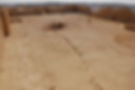
The so-called fortress of size 43x63m: this is in fact the most ancient location as it used to be the Nabatean caravanserai. It was a vast square area for the camels, with a large cistern at the middle (that collected rain and flood waters), and small rooms surrounding it for the traveling merchants. In Roman and Byzantine times, it was turned into a fortress which was a place of refuge in case of danger (attacks from nomadic tribes for example). The difference of stones used in the contruction throughout the site gives an indication of the period: the hammer-dressed stones indicate an early period while the uniform ashlar stones indicate a late Roman-Byzantine period.
Roman army camp, on eastern slope of the caravanserai: it can be viewed by going up a metal staircase of a tower in the fortress. The camp was discovered in the 1980’s. It is of size 100x100m, well preserved, and assumed to date from the Diocletian Limes (ca. 300 CE). The Limes were the new frontiers that were established in the Roman empire, with army camps.
Outside the caravanserai, attached to the immediate south-western wall, are the remains of the Nabatean cultic place, with explanation displays about the Nabatean gods. This cultic place was established around the 1st century BCE (according to one of the inscriptions) and continued to operate up to the 3rd century CE, when the city started to convert to Christiniaty. But this pagan place was not destroyed, as one would have expected, maybe out of consideration for ancient beliefs and for gods' protection.
Acropolis: this is the Byzantine cultic area with two churches

The northern church: the earliest church in Avdat. It was built over an ancient pagan temple because we can notice the reuse of some stones. Inscriptions about Oboda and other royal Nabatean members were found there, so one can assume the ancient deified king had been buried in this temple. These inscriptions date from 286 CE, many years after the death of the king: it denotes the respect that the city kept for him, even after it converted to Christianity. The church was built in the 4th century CE and an adult baptistery was added for mass conversion of the population, as well as a baptistery for children. From the lookout platform of this church, you can see the area stretching in the valley below, as well as other sites of Avdat such as the Byzantine bathhouse below.


The southern church: it is shaped in a typical Byzantine architecture with atrium and water well, narthex, church with three naves and three entrances (one central, broader, and one small, narrower, on each side), columns, tombs under marble slabs (one of them showing a menorah), etc. Inscriptions show dates of the period 541-618 CE. A martyr is mentioned as St Theodoros. Because of the habitations around this church, it is assumed that it was part of a monastery that ceased functioning at the time of the Arab invasion (7th century).

Outside the city, on the slopes of the hill, there is a Roman burial cave dated of the 3rd century CE. It contains over 20 burial niches hewn into the rock, lintel with pagan cultic items (sun, moon, altar). An inscription in Greek gives the names of priestesses from cult of Aphrodites.
At the bottom of the hill, near the entrance to the national park, there is a bathhouse which was built in the Byzantine period. The reason for it to be built there, outside the city, was the need for water supply.
Outside the southern site of the national park, you can notice agricultural development: this is the Even-Ari farm, started in the 1960's, to try grow plants and prove the agricultural activity in Avdat according to ancient techniques. In 2026, there should be enough grapes to produce the first wine.
The above is just a snapshot of what is the most important to see in Avdat, but there are more details and beautiful landscapes to be discovered on site.
I hope that you will enjoy the visit to Avdat, and to the Negev in general. If you wish to be driven and guided there with a door to door service, don't hesitate to contact me or one of my colleagues.
Albert Benhamou
Private Tour Guide in Israel
Kislev 5786, November 2025
